


PRECINCT 04, Delaware County, Indiana
About
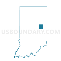
Outline

Summary
| Unique Area Identifier | 576874 |
| Name | PRECINCT 04 |
| County | Delaware County |
| State | Indiana |
| Area (square miles) | 1.20 |
| Land Area (square miles) | 1.20 |
| Water Area (square miles) | 0.00 |
| % of Land Area | 100.00 |
| % of Water Area | 0.00 |
| Latitude of the Internal Point | 40.22374470 |
| Longtitude of the Internal Point | -85.43301510 |
Maps


Graphs
Select a template below for downloading or customizing gragh for PRECINCT 04, Delaware County, Indiana


Neighbors
Neighoring Voting District (by Name) Neighboring Voting District on the Map
- PRECINCT 08, Delaware County, IN
- PRECINCT 10, Delaware County, IN
- PRECINCT 36, Delaware County, IN
- PRECINCT 47, Delaware County, IN
- PRECINCT 49, Delaware County, IN
- PRECINCT 50, Delaware County, IN
- PRECINCT 56, Delaware County, IN
- PRECINCT 68, Delaware County, IN
- PRECINCT 70, Delaware County, IN
- PRECINCT 74, Delaware County, IN
Top 10 Neighboring County Subdivision (by Population) Neighboring County Subdivision on the Map
- Center township, Delaware County, IN (69,199)
- Mount Pleasant township, Delaware County, IN (14,102)
- Hamilton township, Delaware County, IN (7,206)
- Harrison township, Delaware County, IN (3,377)
Top 10 Neighboring Place (by Population) Neighboring Place on the Map
Top 10 Neighboring Unified School District (by Population) Neighboring Unified School District on the Map
- Muncie Community Schools, IN (69,199)
- Delaware Community School Corporation, IN (15,007)
- Mount Pleasant Township Community School Corporation, IN (14,102)
- Wes-Del Community Schools, IN (5,404)
Top 10 Neighboring State Legislative District Lower Chamber (by Population) Neighboring State Legislative District Lower Chamber on the Map
Top 10 Neighboring State Legislative District Upper Chamber (by Population) Neighboring State Legislative District Upper Chamber on the Map
Top 10 Neighboring 111th Congressional District (by Population) Neighboring 111th Congressional District on the Map
Top 10 Neighboring Census Tract (by Population) Neighboring Census Tract on the Map
- Census Tract 24.02, Delaware County, IN (8,662)
- Census Tract 26.01, Delaware County, IN (7,206)
- Census Tract 9.04, Delaware County, IN (5,492)
- Census Tract 25, Delaware County, IN (5,404)
- Census Tract 29, Delaware County, IN (4,915)
- Census Tract 9.03, Delaware County, IN (2,786)